VOGELER LAB
  • Home
  • Projects
  • Lab Members
  • Publications
  • Data Products
  • Contact

GEDI Data Fusions for Characterizing Wildlife Habitat & Biodiversity

Project Summary

Picture
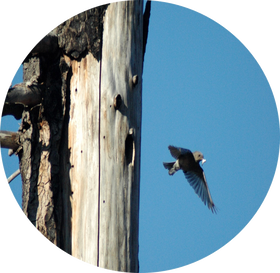
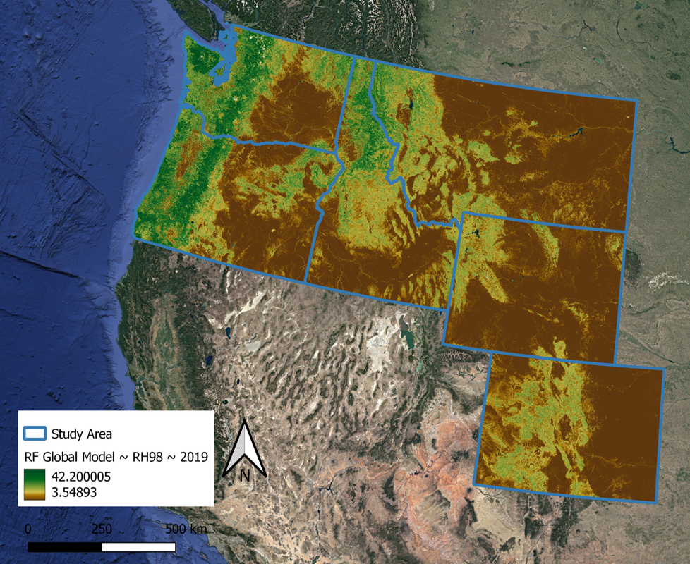
Animals respond to both horizontal and vertical patterns in forest structure. Habitat modeling efforts that include forest structure can therefore provide more accurate representations of habitat quality and biodiversity. Although airborne lidar is effective for characterizing vertical structure in forests, the limited spatial extent of this data creates challenges for studying wide-ranging animals. Spaceborne lidar, like GEDI, is likely to provide important vertical structural data at extents that will assist in 1) landscape management of critical animal habitat, and 2) identification of areas of high biodiversity. GEDI data additionally serves as a freely available reference data set for creating moderate resolution continuous maps of structure through fusions with additional publicly available remote sensing data. In this project, we will assess the trade-offs of using GEDI in combination with other freely available remote sensing products to produce wall-to-wall GEDI-derived forest structure metrics that are important for animals across five western U.S. states (WA, OR, ID, WY, CO). 

Research Objectives

Objective 1

Assess the trade-offs in different remote sensing data fusions and modeling approaches for the creation of continuous forest structure characteristics.

Objective 2

​Explore whether structure products from Objective 1 effectively capture the distribution and essential habitat components for a suite of
forest mammal and bird species.

Objective 3

​Investigate how products from Objectives 1 and 2 characterize the diversity of birds and mammals across differing forest types.
Picture

Project Outputs

Publications
Barry, B., Holbrook, J., Vogeler, J., Elliott, L., Weldy, M., Lesmeister, D., Epps, C., Wilson, T., & Vierling, K. (2024). Using spaceborne LiDAR to reveal drivers of animal demography. Ecological Applications, p.e3048. https://doi.org/10.1002/eap.3048

​
Elliott, L.H., Vierling, K.T., Holbrook, J.D., Barry, B., & Vogeler, J.C. (2024). Using GEDI data fusions to map keystone cavity excavator distributions and associated biodiversity hotspots in the Marine West Coast Forest ecoregion, USA. Environmental Research Letters (GEDI for Biodiversity Special Issue), 19(9), p.094027.  https://doi.org/10.1088/1748-9326/ad64eb

​
Vogeler, J.C., Fekety, P.A., Swayze, N.C., Filippelli, S.K., Barry, B., Elliot, L., Holbrook, J.D., & Vierling, K.T. (2023). Evaluating GEDI data fusions for continuous characterizations of forest wildlife habitat. Frontiers in Remote Sensing: Women in Remote Sensing Special Issue (Invited), 4, p.1196554. ​https://doi.org/10.3389/frsen.2023.1196554

​
Smith, A. B., Vogeler, J. C., Bjornlie, N. L., Squires, J. R., Swayze, N. C., & Holbrook, J. D. (2022). Spaceborne LiDAR and animal-environment relationships: An assessment for forest carnivores and their prey in the Greater Yellowstone Ecosystem. Forest Ecology and Management, 520, 120343. https://doi.org/10.1016/j.foreco.2022.120343
Spatial Data Products
Vogeler, J., P.A. Fekety, and K. Vierling. (2023). GEDI-Fusion Structure Metrics Western US, 2016-2020. ORNL DAAC, Oak Ridge, Tennessee, USA. https://doi.org/10.3334/ORNLDAAC/2236 ​
Picture

Project Team & Funding

Collaborators
Dr. Kerri Vierling - University of Idaho (Project PI)
Dr. Joseph Holbrook - University of Wyoming (Co-I)
Funding Agency
Picture
Picture

address

Vogeler Research Lab
Colorado State University
Campus Delivery 1499
Fort Collins, CO 80523
USA

email

GitHub

Photo Credits
[email protected]
Picture
 Kevin Buffington & lab member contributions
© Vogeler Lab 2025
Proudly powered by Weebly
  • Home
  • Projects
  • Lab Members
  • Publications
  • Data Products
  • Contact