Project Summary
|
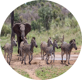
This project will develop an innovative forecasting framework for South African protected area managers, focusing on changing aspects of ecological connectivity. More particularly, we will be studying the edge interfaces of protected areas and rapidly expanding, semi-urban settlements, in a region that has been the subject of one of the largest forms of rewilding land conversion on the planet: South Africa’s Greater Kruger National Park (GKNP) region. A biodiversity hotspot, the GKNP region has on the one hand been subject to dramatic land use/land cover change (LCLUC) over three decades including fragmentation, habitat loss, human-wildlife conflict, and urbanization. On the other hand, it has also experienced extensive rewilding, including the widespread replacement of cattle farming with wildlife, the removal of fences to form larger contiguous protected areas, and the return of land rights to rural communities. These changes have produced a complex mosaic of varied land uses and conservation management regimes, including the world renowned Kruger National Park, private and municipal nature reserves, and communal lands under traditional authorities, bracketed by rapidly expanding settlements. Using a unique synthesis of earth observation and terrestrial data products, we will produce forecasting tools that will aid in understanding future habitat suitability and species dispersal, landscape change under new conditions of rewilding, and effective planning for new biodiversity corridors that include, rather than ignore, locally urbanizing zones.
|
Research Questions
Question 1How have vegetation patterns and wildlife habitat connectivity for a set of focal indicator species been impacted by rewilding activities following changes in protected area boundaries and mixed land-use configurations across the last 30 years?
|
Question 2What are some of the identified drivers, impacts, and trends of both natural and
anthropogenic disturbance events within buffer zones along the edges of GKNP (e.g. fire, elephant impacts, urbanization)? |
Question 3What spatial products and forecasting tools would fill current data gaps in support of
informed decisions on land planning by a variety of managers and user groups in the region? |
CollaboratorsDr. David Bunn - University of British Columbia (co-PI)
Dr. Melissa McHale - University of British Columbia (Co-I) Dr. Neil Carter - University of Michigan (Co-I) Dr. Sharon Hall - Arizona State University (Co-I) |
Funding Agency: NASA
|
address |
|
